ZIONSVILLE GATEWAY AREA STUDY
Community serving. Community led.
The Town of Zionsville called on the community to help strategically and thoughtfully re-invent the gateway into the Village Business District.
This study supports the White River Regional Opportunity Initiative Partnership. Learn more about the WR-ROI here, and continue scrolling to explore the ZGA Study.
THE MISSION
“Identify the highest, best, and most sustainable mix of uses within the Zionsville Gateway Area (ZGA) and to explore ideas for an ECONOMICALLY VIBRANT, WHOLE-COMMUNITY SERVING and AUTHENTICALLY ZIONSVILLE EXPERIENCE.”
Generated by the Town of Zionsville, this mission statement highlights the importance of identifying an economically vibrant outcome for the Zionsville Gateway Area (ZGA). The Town’s goal is to address the area’s challenges and promote development that compliments the activity and character of the Village, especially along Main Street. To do this, the Town is looking to identify the highest and best uses in a development plan for the ZGA. This plan likely includes a mix of public and private developments that brings together greenspace, public plazas, parking, and a variety of commercial, residential, and mixed-use developments. The Town engaged DELV Design (DELV) and Thomas P. Miller & Associates (TPMA) to better understand the type of development residents would like to see, and how these preferences could take shape. This is the compilation of findings from that study and early thoughts about how they could shape the future of the ZGA. This study complements the Town’s decade-long effort to develop and re-invigorate Zionsville’s entrance to the Village.
INTRODUCTION: What is the ZGA?
On July 28, 2020, following the demolition of the PNC bank building and locksmith shop at the northwest corner of Main and Sycamore Streets, the Town of Zionsville began the first stage of the planning for what would become known as the Zionsville Gateway Area, or the ZGA.
The ZGA represents an underutilized area of downtown Zionsville. It is the southern entry point and major gateway into the village business district, however, it lacks the same sense of place as the adjacent Village. The Town recognizes the potential boon to the overall economy and understands the need to revitalize the area.
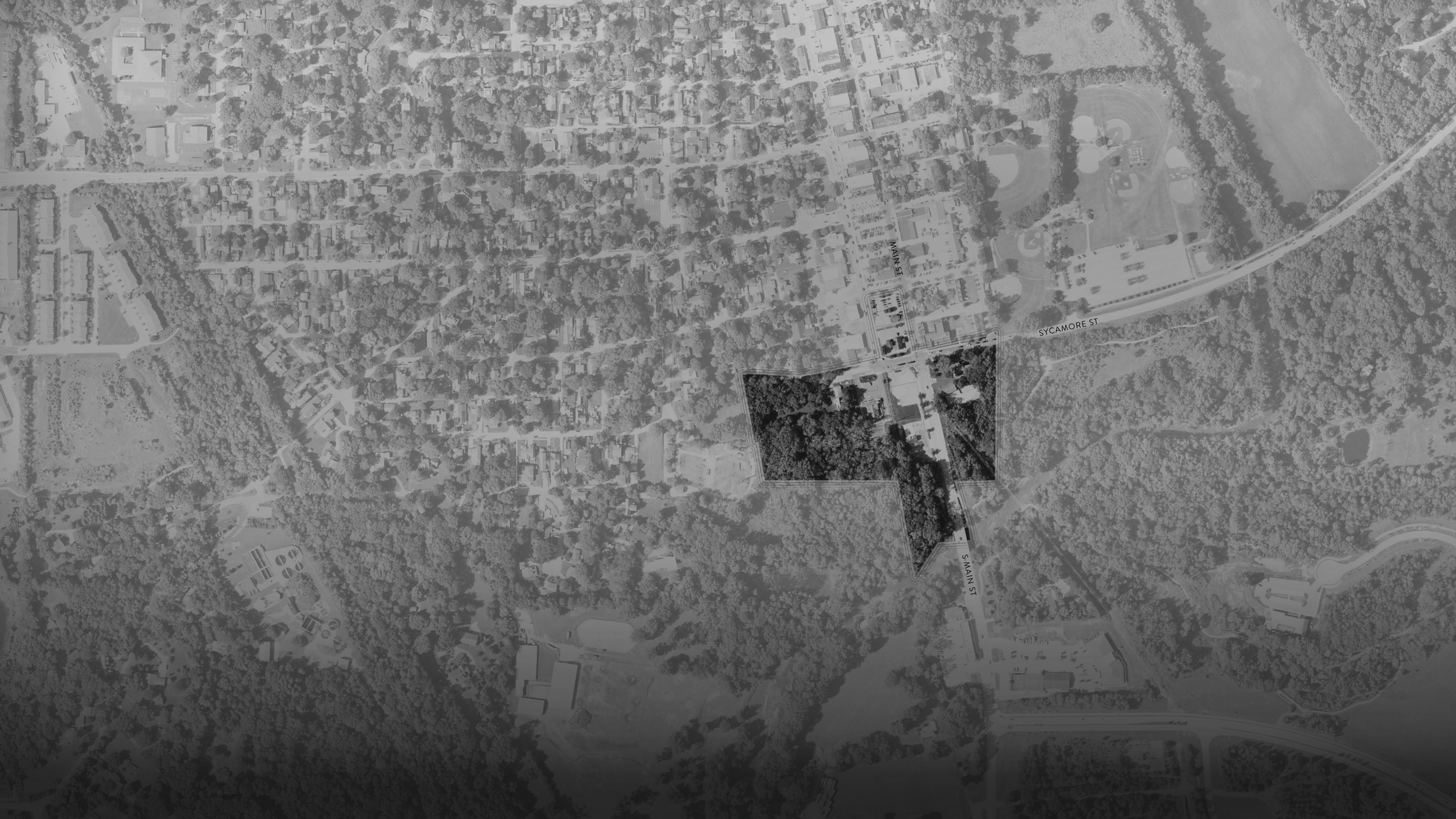
The adjacent illustration outlines the boundary of the ZGA used for the purposes of this study. The ZGA's northern boundary is loosely based on Sycamore Street and includes land surrounding the intersection of Sycamore Street and Main Street. Creekside Nature Park generally represents the boundary to the east, and private property is the area’s boundary to the west. Eagle Creek is the extreme southern boundary, but land adjacent to South Main Street on the east and west is also included. A parcel of land north of Sycamore Street is also included within the boundary of the ZGA. Currently owned by The Town, that parcel is being used today as a surface parking lot.
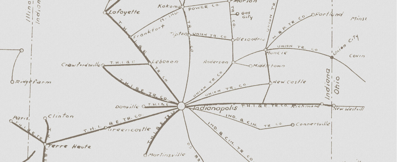
HISTORIC PASSENGER CONNECTIONS Photo courtesy of Zionsville Life
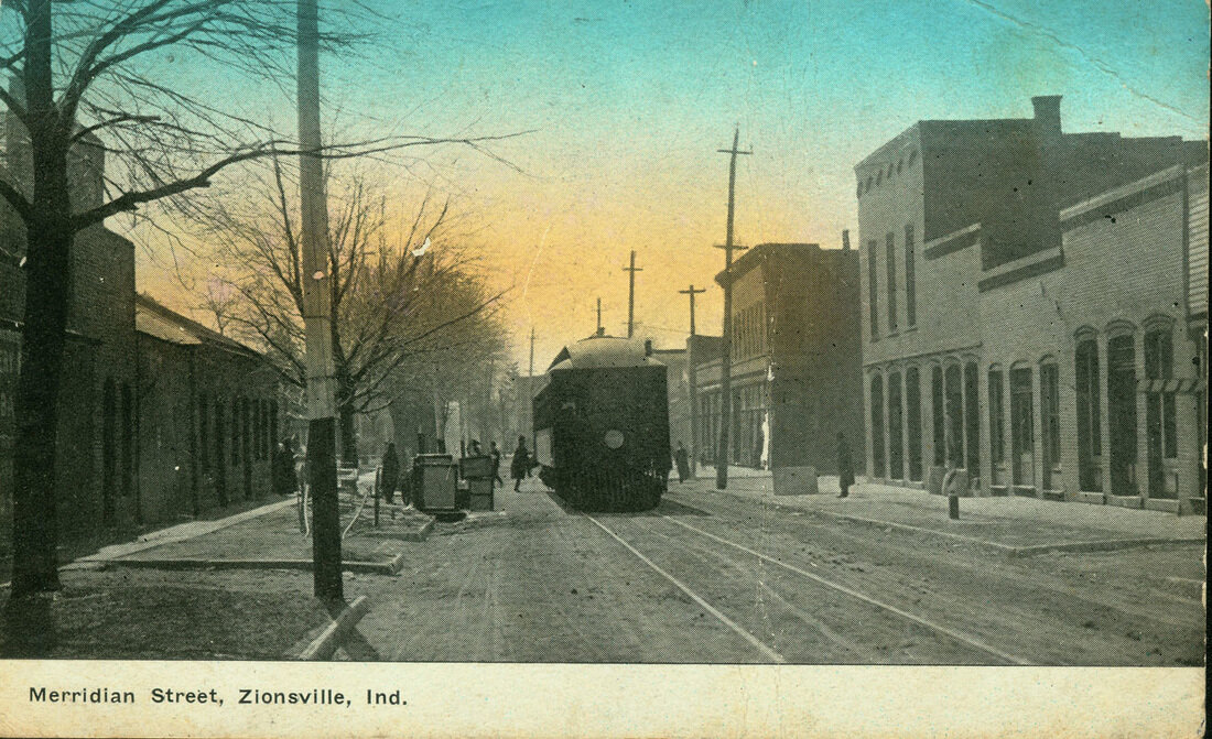
MERRIDIAN ST, ZIONSVILLE, IN
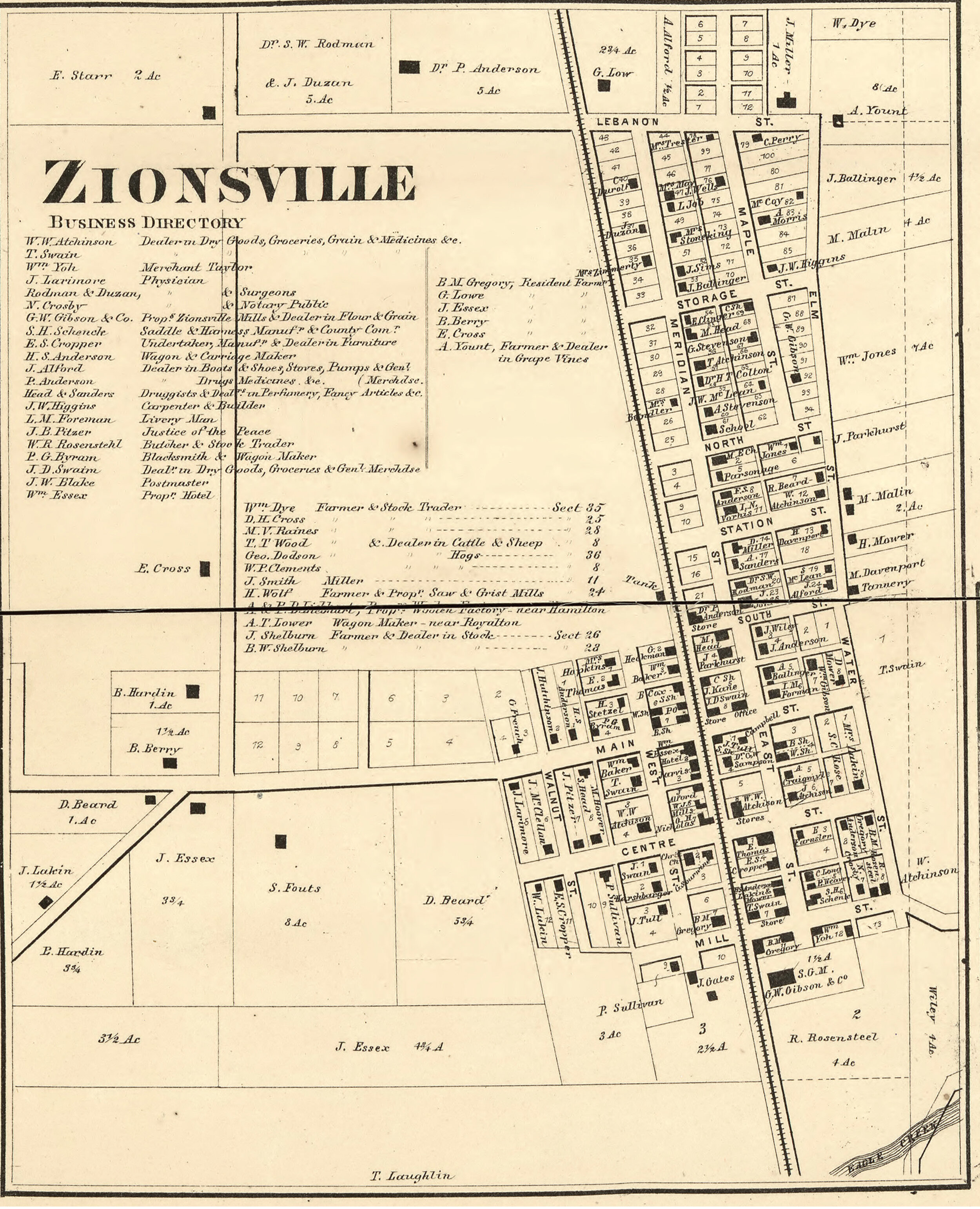
1865 MAP OF ZIONSVILLE
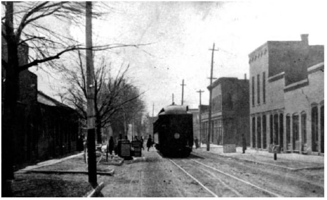
INTERURBAN ALONG MAIN ST Photo from Remembering Zionsville
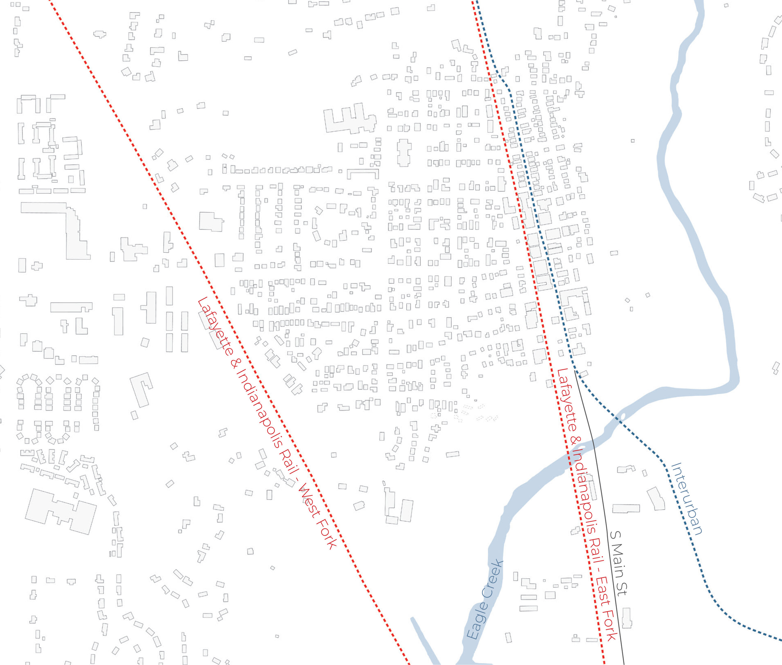
HISTORIC RAIL LINE ROUTES
PROCESS + APPROACH
Based on design thinking methodologies, TPMA and DELV identified three main objectives to guide the Town through this study. The three main objectives are:
Understand. During this stage, we will uncover issues the Town believes need to be solved as part of the redevelopment. In other words, we want to be sure we’re working toward solving the right problem or problems.
Explore. Potential solutions and multiple options will be generated during this stage. Multiple methods of solving the problem or problems uncovered in the Understand stage will be studied and discussed. Feedback will be taken and suggestions will be formed that incorporate the best of all viewpoints and serve the greatest good. In other words, we want to solve the problem or problems the right way.
Implement. This is a future stage of the process and involves additional steps. Real-world technical studies will be undertaken to develop the process, timeline, budget, financial methodologies, technical drawings, and specifications needed to make the suggestions you see here a reality. Feedback will be garnered throughout this stage.
What does the community want?
To ensure we were meeting the Town’s stated goal of creating a “whole-community serving” experience – we needed to include the community in the process. In-person listening sessions with the greater community, individual stakeholder interviews, and on-line surveys were methods used to obtain stakeholder and resident input. This uncovering of thoughts helped us understand what the community valued and thought necessary to create a successful extension of the downtown area. Information gathered from those encounters revealed the following general thoughts:
Traffic congestion in the area is generally considered a problem
Traffic speed is considered to be too high
Public gathering spaces in the form of greenspaces or plazas are highly desired
Non-vehicular connections to trails, waterways, and walking paths are desired
Maintaining the quaint, mid-rise scale of the Village area is a priority
How can we provide it?
With the data and input from the Understand phase, the team created the following list of major influences and design tenets. They would be used as guideposts for design concepts related to how the ZGA could be developed. The list included:
Reduce traffic congestion
Reduce traffic speed throughout the downtown area
Support the creation of public plazas and greenspaces
Support connections to adjacent trails, pedestrian paths, Eagle Creek, and the overall White River watershed
Support the creation of amenities such as public restrooms and multi-use structures
Maintain a development density and scale that is complimentary to the existing downtown and neighborhood areas
Work to create a stronger connection between the existing downtown area and the Creekside Corporate Park area
Work to incorporate and uphold the principles of New Urbanism within the area
DEVELOPMENT SUGGESTIONS
A DESIGN CONCEPT: How could it all work?
We believe all the Town’s goals for the ZGA are conceptually achievable and as such, the future of the area looks very bright.
The diagram adjacent is a design concept that incorporates those Town goals. Major design elements in this concept include the continuation of 1st Street south past Sycamore Street – connecting to a rerouted South Main Street bent to the west as it crosses Eagle Creek. This allows the creation of a pedestrian boulevard in the original location of South Main Street south of Sycamore Street. An open public area between these elements (Parcel E) will create a unique entry sequence and a bold statement about the value of community spaces. It should incorporate a park, a hardscape plaza, or any combination therein. Two and three-story mixed-use parcels containing retail, office, and residential components flank the north, east, and west sides of Parcel E. The underutilized north parcel owned by the Town dovetails new development with the historic Village area, while the east and west parcels define the open area within mid-rise urban boundaries. To the west a residential parcel with two-story townhomes will reduce the overall scale of development and act as a transition to the existing neighborhood. Also included in this concept are multiple greenspace buffers and trails which connect to existing amenities or suggest the development of new pathways to surrounding areas. Completed market studies and calculations have shown that this development concept is a viable way to ensure continued growth of the downtown area without sacrificing what makes Zionsville unique.
October Presentation
Recent Updates (10/4/21)
FINAL STUDY
Questions? Contact Us:
Zach Lutz
Planner
Town of Zionsville
zlutz@zionsville-in.gov
317.344.1169


